.png)
 1 hour ago
4
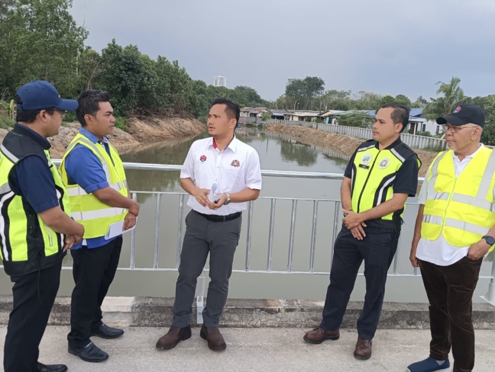
PASIR GUDANG, Nov 3 — The Johor government will focus on 337 flood hotspots statewide as the northeast monsoon is expected to affect the state from this month until January next year.
State Public Works, Transport, Infrastructure and Communications Committee chairman Mohamad Fazli Mohamad Salleh said priority would be given to areas with high population density and a history of major flooding, including the districts of Kota Tinggi, Batu Pahat and Segamat.
“Based on updates from the Department of Irrigation and Drainage (DID), 35 flood hotspots, including new additions, have been identified.
“The Public Works Department (JKR) has also identified 30 high-risk road locations that comprise 21 sites on federal roads and nine on state roads,” he told reporters after a working visit to the Sungai Rinting flood wall project here today.
Also present were Permas assemblyman Baharudin Mohamed Taib and senior government agency officials.
Mohamad Fazli said the measures outlined included hotspot mapping, drain maintenance, cleaning and dredging drainage systems, ensuring machinery was ready, public outreach and the use of the eBencana (electronic disaster) reporting system.
He said the relevant projects included Phase 1 of the Sungai Johor Flood Mitigation Plan, the Sungai Pemandi Flood Mitigation Plan and a flood alleviation project in Kampung Sungai Kapal Lama in Pengerang.
In Batu Pahat, Mohamad Fazli said the DID had identified 41 flood hotspots, while the JKR had detected 21 high-risk locations along federal and state roads, covering a total distance of 6.5 kilometres.
He added that preparations would include road pavement maintenance works worth RM11.79 million, non-pavement works worth RM3.20 million and an allocation of RM1.92 million under the Malaysian Road Records Information System (MARRIS) for drainage-related works.
“Alternative route plans via the FT024 federal road and the PLUS Highway have also been planned.
“Mobile pumps at the Parit Botak sluice gate, flood mitigation projects – such as the Bandar Batu Pahat and Sungai Batu Pahat flood mitigation schemes – as well as coastal embankment upgrading works, are also being given due attention,” he said.
In Segamat, Mohamad Fazli said the DID had identified 29 flood hotspots, while the JKR had identified 16 high-risk locations, comprising eight federal roads and eight state roads.
“Efforts are also focused on monitoring river levels and roadways, as well as coordinating with the Batu Pahat district, which is located downstream,” he said.
In Muar, he said 65 flood hotspots had been identified, the highest number among the districts listed by the DID.
In Tangkak, 26 hotspots had been identified, with priority measures including inspecting culverts and drainage systems, monitoring roadways and coordinating maintenance efforts among the relevant agencies.
Mohamad Fazli said there were also 44 flood hotspots in Johor Bahru, 29 in Kluang, 19 in Pontian, 27 in Kulai and 22 in Mersing.
In a related development, he said the state government was preparing an application for an emergency allocation of between RM20 million and RM30 million to carry out maintenance works and flood preparedness measures in high-risk areas throughout November and December.
“Priority will be given to tasks that can be executed immediately, specifically maintenance work, whereas large-scale projects, such as the construction of embankments and flood-retaining walls, will require a longer timeframe,” he added.







 English (US) ·